- Author Centrefarm Aboriginal Horticulture Limited
- Publish date 18 January 2023
- Type Report
- ISBN 978-1-922437-43-3
- Documents
- First Nations led business development
- Horticulture
- Strategic policy development
Summary
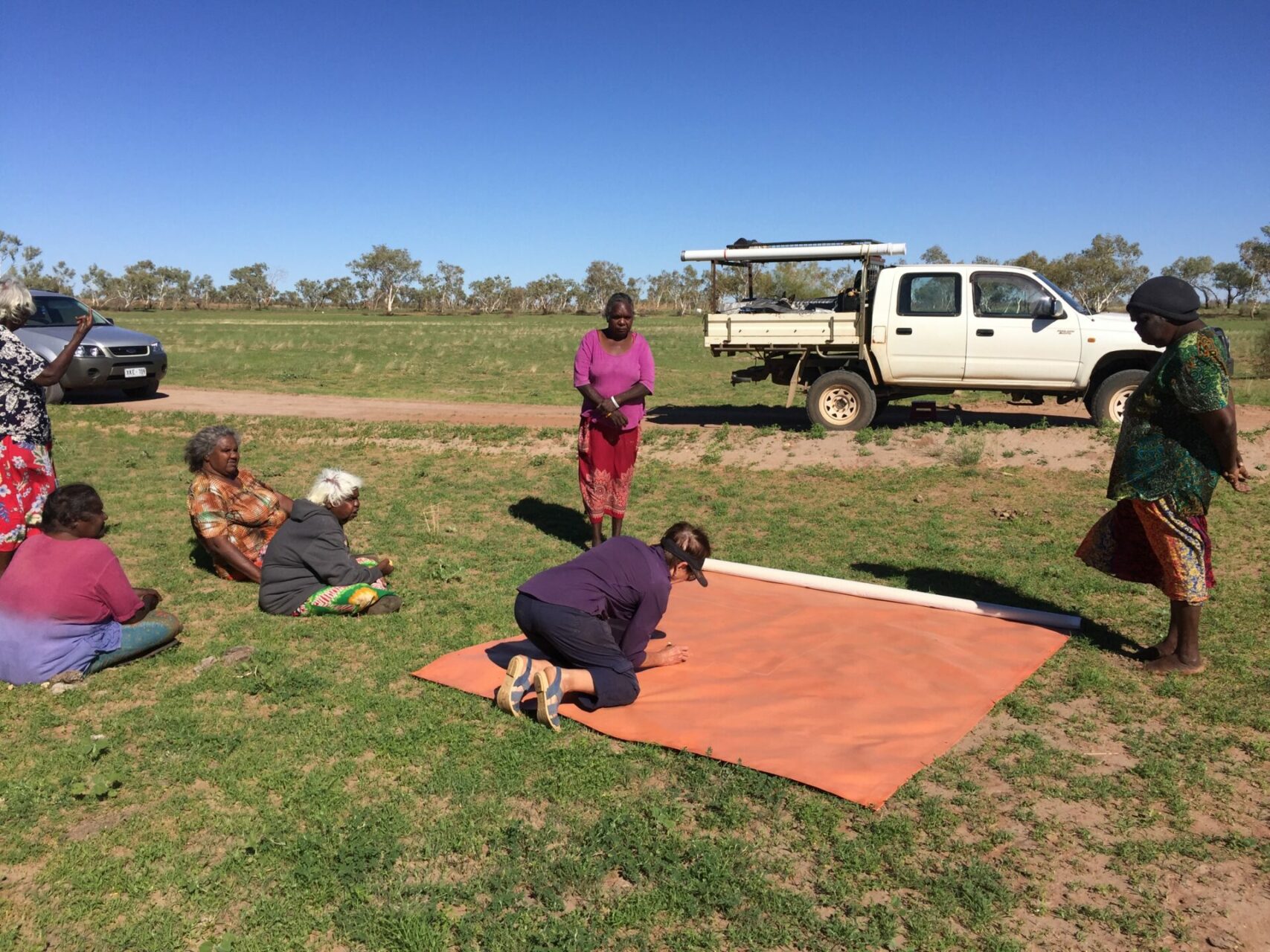
Centrefarm Aboriginal Horticulture Limited (Centrefarm) lead this Co-Mapping on Country project involved a series of workshops from 2019-2022 with Traditional Owners of the Warrabri, Wubalawun and Mangarrayi Aboriginal Land Trusts ( in the Northern Territory) to develop two large multi-purpose canvas maps of the regions. The research aimed to co-create maps that could be used as a platform to facilitate communication, discussion, and decision-making, while supporting intergenerational knowledge transfer, and educate non-Aboriginal people about the Country they are on.
Although there were several Covid-19 related delays, the project successfully achieved its key goals and developed Co-Mapping methodologies that may be used by others wishing to undertake similar work. The use of an embedded Developmental Evaluator throughout the project allowed for key learnings to be evaluated and implemented in real time throughout the process.
In addition to the original goal of developing a Co-Mapping manual and training guide, accompanied by a workbook and ‘toolkit’, a comprehensive Co-Mapping Model has been created providing a proven process for others wishing to undertake Co-Mapping. This process applies to any socio-economic development activity non-Aboriginal people undertake with Aboriginal people and demonstrates how to collaborate in intercultural contexts.
The project draws on a range of national and international approaches to Co-Mapping. In the national context, given the challenges facing Aboriginal peoples, and the failure so far of governments to address them over past decades, the imperative to work with, or collaborate on an equal footing, is the only way forward—not just for governments, but any organisation or group wanting to address disadvantage and capitalise on the strengths of people and organisations that already exist. If there is a real desire to support Aboriginal people to develop their lands in Northern Australia, it is critical that Co-mapping methodology is employed, and that two-way governance and Free Prior and Informed Consent are central to this process.
Centrefarm staff and associates have benefited from managing and delivering Co-Mapping in ways that will reverberate positively in Alekarenge and Mataranka as our efforts to improve the socio-economic circumstances of Aboriginal people continue. This project has given Co-Mapping, co-design and two-way governance a legitimacy that enables Centrefarm to consolidate and place itself on a solid footing.
Projects
Co-mapping on Country: Train the trainer for sustainable development
Co-mapping on Country involves creating large multi-purpose maps on canvas in collaboration with Traditional Owners to facilitate engagement, discussion, communication, and informed decision making for the primary purpose of utilising Aboriginal land for economic development. These maps are also used for cultural maintenance, education, including inter-cultural education. In particular: Maps are excellent ‘boundary objects’ which help negotiate the spaces between different cultures and knowledges. They are tangible items which facilitate discussion, planning and decision-making in complex inter-cultural environments. Aboriginal and Torres Strait Islander peoples value maps for a range of reasons. Developing a two-way map is an effective engagement tool with land at the centre. The training of other artists/intercultural communicators in the process of co-mapping will enable access to a pool of people with expertise to assist the Aboriginal Land Economic Development Agency (ALEDA) meet its goals for economic development, enabling more two-way maps to meet the objectives in (1) above. Underpinning the training is the desire to ‘grow’ the expertise of others to do this important cross-cultural work. The co-mapping process and the resulting maps are multi-purposed but for this project, the objective is to provide the appropriate foundation required for successful planning and implementation of commercial development on Aboriginal land and enable that information to then be used to plan development activities that fit with the aspirations and expectations of all stakeholders. The co-mapping process and maps will provide critical information required for successful commercial development on Aboriginal land by enabling discussion, planning, intercultural understanding, decision-making and implementation of development activity which fits with aspirations and expectations of all stakeholders. The maps record: exclusion zones flora and fauna women’s and men’s cultural sites basic topography and hydrology, cadastre infrastructure ecological features and water sources They can be used to identify areas best suited for development, using the local Indigenous languages and English.