- Reference # AT.4.1819006
- Project Status Current
- Timeframe 15 months
- Project manager Sarah Docherty
- CRCNA Funding $223,868.00
- Total project value $490,465.00
- Project research participant Charles Darwin University
- Research Programs 4. Building industry and capacity in Northern Australia
- Location Alekarenge, Mataranka, Wadeye
- First Nations led business development
- Strategic policy development
Summary
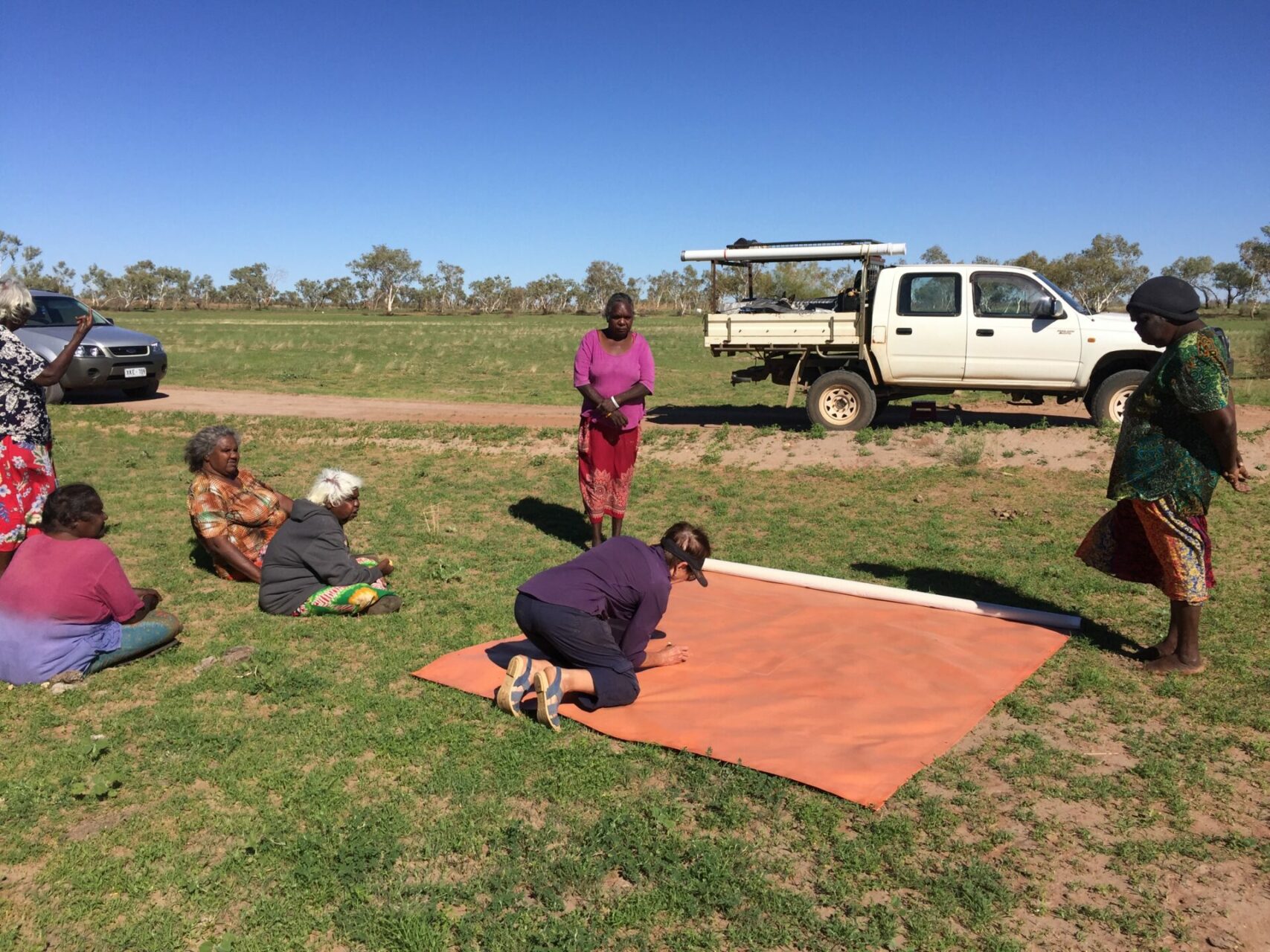
Co-mapping on Country involves creating large multi-purpose maps on canvas in collaboration with Traditional Owners to facilitate engagement, discussion, communication, and informed decision making for the primary purpose of utilising Aboriginal land for economic development.
These maps are also used for cultural maintenance, education, including inter-cultural education. In particular:
- Maps are excellent ‘boundary objects’ which help negotiate the spaces between different cultures and knowledges. They are tangible items which facilitate discussion, planning and decision-making in complex inter-cultural environments. Aboriginal and Torres Strait Islander peoples value maps for a range of reasons. Developing a two-way map is an effective engagement tool with land at the centre.
- The training of other artists/intercultural communicators in the process of co-mapping will enable access to a pool of people with expertise to assist the Aboriginal Land Economic Development Agency (ALEDA) meet its goals for economic development, enabling more two-way maps to meet the objectives in (1) above. Underpinning the training is the desire to ‘grow’ the expertise of others to do this important cross-cultural work.
- The co-mapping process and the resulting maps are multi-purposed but for this project, the objective is to provide the appropriate foundation required for successful planning and implementation of commercial development on Aboriginal land and enable that information to then be used to plan development activities that fit with the aspirations and expectations of all stakeholders.
The co-mapping process and maps will provide critical information required for successful commercial development on Aboriginal land by enabling discussion, planning, intercultural understanding, decision-making and implementation of development activity which fits with aspirations and expectations of all stakeholders. The maps record:
- exclusion zones
- flora and fauna
- women’s and men’s cultural sites
- basic topography and hydrology, cadastre
- infrastructure
- ecological features and water sources
They can be used to identify areas best suited for development, using the local Indigenous languages and English.
Expected outcomes
- Develop a new model and approach to Indigenous-led economic development on Aboriginal land which will form the foundation of a new approach to Indigenous-led economic development and bridges the gap between two knowledge groups for the benefit of Northern Australia.
- The resulting maps will form the foundation of a detailed planning process and portfolio for Aboriginal-led commercial development, while the co-mapping methodologies and training toolkits will be trialed by the Aboriginal Land Economic Development Agency (ALEDA) in its five-year pilot phase of the NT-wide Economic Development Strategy (EDS), which includes six at-scale commercial projects. Project modelling predicts these six ALEDA pilot projects will provide direct economic value of approximately $30.9m in year 5 and $34.7m in year 10.
Publications
18 January 2023
Co-mapping on Country: Authority comes from Country
Type: Report
Industry: First Nations led business development, Horticulture, Strategic policy development