


- Author CRCNA and research partners
- Publish date 1 October 2026
- Type Report
- Documents
- First Nations led business development
Summary
This impact evaluation highlights the outcomes of a CRCNA-supported project, Integrating Indigenous priorities in spatially enabled planning of the Indigenous Estate (A.2.2122028). Strengthening First Nations-led land and sea management across the Groote Archipelago in the Northern Territory.
Led by the Anindilyakwa Land Council in partnership with Aerometrex, Geoscience Australia and the Australian National University, the project integrated Traditional Owner knowledge with advanced geospatial technologies, including aerial imagery, LiDAR and spatial mapping.
The evaluation documents the project’s achievements in strengthening local capability and decision-making, supporting cultural and environmental management, creating employment and facilitating subsequent research funding.
It also explores the longer-term potential for community-controlled spatial data to support climate adaptation, infrastructure planning and economic development, while providing a model for Indigenous-led spatial planning across northern Australia.
Projects
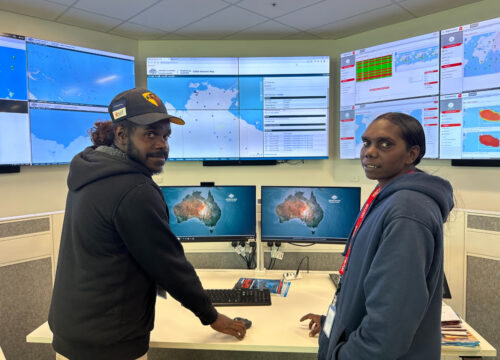

Integrating Indigenous priorities in spatially enabled planning of the Indigenous Estate
Geographic Information Systems (GIS) are essential tools for natural resource management, environmental monitoring and economic development. However, remote First Nations organisations face significant barriers to accessing these technologies, particularly where conventional mapping systems do not adequately reflect Traditional Owner knowledge and cultural priorities. Led by the Anindilyakwa Land Council (ALC), this project developed a community-led approach to spatial planning across the Groote Archipelago in the Northern Territory, combining advanced geospatial technologies with Anindilyakwa cultural knowledge to support informed decision-making about Country. Delivered in partnership with Aerometrex, Geoscience Australia and the Australian National University, the project integrated high-resolution aerial imagery, LiDAR, terrain modelling and participatory mapping into a community-controlled geospatial information system. Aerial surveys covering approximately 3,375 km² generated foundational spatial datasets to support land and sea management, cultural heritage protection, infrastructure planning and climate adaptation. Project outcomes and impact Completed in 2026, the project delivered significant benefits for the Anindilyakwa Land Council, including: First Nations capability: Strengthened Traditional Owner participation in planning and decision-making, supporting cultural authority and Indigenous data sovereignty. Employment and skills: Supported approximately 7.5 FTE years of employment, local technical training and two postgraduate research students. Reduced costs: Established reusable spatial datasets, reducing duplication of surveys and improving efficiencies across land management, infrastructure and research activities. New investment: Contributed to approximately $1.56 million in subsequent cash and in-kind research funding through the strengthened ALC–Australian National University partnership. Cultural and environmental benefits: Improved cultural heritage mapping, environmental monitoring and coastal risk assessment. The project received the 2024 NT Geospatial Excellence Award for Community Impact, recognising its innovative, community-led approach. A lasting legacy The project’s spatial datasets and planning tools provide an enduring resource for the ALC, supporting ongoing Sea Country management, cultural heritage protection, climate adaptation and future economic development opportunities. The research also establishes a practical model for other First Nations organisations across northern Australia to integrate cultural knowledge with advanced geospatial technologies while maintaining ownership and control over their spatial information. Watch the video